
Hikes in the Park
Joshua Tree National Park, California
When is the Best Time/Season to Hike?
SEASON
Fall / Winter / Spring!!
Avoid Summer hikes! Days are very hot! And it is dangerous to go for 'morning hikes' in the park because once the sun rises, it gets very hot, very quickly. Evening hikes are best - in the moonlight.
TIME OF DAY - Fall / Winter / Spring
Early in the Morning
Get up well before the sun rises, watch the desert be illuminated...
...and you just might spot some Coyotes!Sunset/Twilight
This time lingers for a few hours.
It's a great time for taking twilight photos.In the Dark (In winter it is dark at 6pm!)
Try it! This is one of the best times to explore.
And if the moon is up, you won't need a headlamp.During the Mid Day
This is only appropriate during the Fall/Winter/Spring months.
It's too hot in the summer months.

Please Respect Park Rules
NO PETS ON TRAILS
Pets are NOT allowed on the hiking trails. Pets are allowed on dirt roads, and must be within 100 feet from the road.
PLAN AHEAD FOR BUSY WEEKENDS
The park gets crowded by 10am on weekends (And Holidays). It is best to get into the park early. If you must enter the Park between 10am-2pm, then it is highly recommended to use the North Entrance (29 Palms). You can then exit via the West (Joshua Tree) entrance.
PARK IN DESIGNATED AREAS ONLY
Please respect all parking signs and regulations! If all of the parking is taken, then try another location. Please do not double-park or park off-road.
Hikes and Trails
Hidden Valley Trail
1 mile loop
Easy
Restrooms at trailhead
Located in the center of the park, right off of Park Blvd. Follow the signs on the main road. There is plenty of parking, as well as some picnic tables and BBQ grills.
This is a classic “Must Do” hike. Hidden Valley is a small “valley” surrounded by natural rock walls. Historically this has been a place for Native Americans and early settlers to find shelter. During the spring, this unique environment offers a wide variety of wildflowers.
Barker Dam Nature Trail
1.3 mile loop
Easy
Restrooms at trailhead
The road to the trailhead is located just east of the Hidden Valley / Intersection Rock area. Follow the signs on the main road. There is a parking lot, but it tends to get filled quickly on weekend/holiday mornings. As always, get there early!
The “dam” was made a long time again in order to retain water for livestock. When there is water in the dam. there is a good chance you will see wildlife on this hike (the earlier the better!) - including Bighorn Sheep and Coyotes. It's a good hike, especially after a big rain when the dam is full.
Lost Horse Mine
4 mile loop
Moderate
This popular trail takes you into an old mining area of the park. The trailhead is located on Keys View Road, a few miles past Cap Rock. Parking is limited, so please be respectful if you get their when the parking area is full.
At the main area, you will find the remnants of a gold and silver mine. It’s great for photography - but remember - take only photos - and leave only memories.
Arch Rock
White Tank Campgrounds
.5 miles
Easy (some bouldering required to explore the arch)
Restrooms in Campground
Arch Rock is in the White Tank Campground. There is very limited parking in the campground, but there is a new parking lot on Pinto Basin Road, just north of the entrance to White Tank - and then you can hike into the arch. Please respect the campers and do not park in their spots or block them. And please be quiet at night.
The Arch Rock trailhead is located inside the campground, near campsite 9. It is a .5 mile hike in. There is some incline. When you get to Arch Rock, you will need to climb on some rocks in order to get a good view of the arch.
If you feel like exploring further, there are a ton of trails behind Arch Rock that lead up the hill. In the spring, this is one of my favorite Wildflower locations. At night, this is a very popular spot for Astro-Photographers!
Again! Please be quiet and respectful of the campers!
Willow Hole
Wonderland of Rocks
Boyscout Trailhead
7 miles
Moderate
Restroom at Trailhead
This is a classic hike in the park which takes you thru the Wonderland of Rocks area - it's known for its views and wildflowers! You will park at the Boyscout Trailhead parking area and proceed from there. Take a map!
Ryan Mountain
3 miles round trip
Moderate
1000 ft elevation change!
Restroom at Trailhead
This is a popular hike which takes you to the top of the central peak in the park. It’s great for sunrise or sunset! There is a 1000 ft elevation change on this hike, so be prepared. It is one of the more strenuous hikes in the park. Once you reach the top you will get amazing views of the entire park - out across the Wonderland of Rocks. Bring your Camera!
The trailhead is located a few miles east of Hidden Valley. There is plenty of parking at the trailhead - and restrooms as well!


Skull Rock
Jumbo Rocks Campgrounds
50 ft!
Super Easy
Skull Rock is right near the road, just east of the Jumbo Rocks Campground entrance. This is a super simple - and fun - destination - day or night! It’s a great place to take photos. Please watch out for cars, as this part of the road can get congested. They recently put up road signs to slow traffic in this area.
Have Fun!

Take a Photography Workshop in the Park
3-Hour Sunset / Sunrise / Landscape Workshops
Small Groups - With an Expert Guide!
Learn Milky Way Photography
Includes Star Trails & Light Painting + Lightroom
B&B lodging in JT included (or camping in the park)
No-Charge for Non-Photographer Spouses

Cholla Cactus Gardens
.5 miles
Easy
Cholla Cactus are also referred to as “Jumping Cactus” - because if you walk past them too close - they appear to jump onto your clothes (or skin) and they are very hard to get off (hint: use a fork to remove them from your clothes or skin!).
The Cholla Cactus Gardens are out on the east side of the park - closer to the Cottonwood entrance. This is a great place for sunrise and sunset photography - and nighttime photography as well. Be careful walking thru the garden as there are a lot of cactus needles on the ground - and they get stuck on your shoes!

Cap Rock
1 mile Loop
Easy
Restroom at Trailhead
Cap Rock is an amazing rock formation. It is located at the begging of Keys View Road - near Park Blvd - east of Hidden Valley. There is usually plenty of free parking - and a restroom.
There is a guided path thru the rock formations - with many informative signs along with way to teach you about the desert. This is a great location for sunrise photography!
Enjoy!
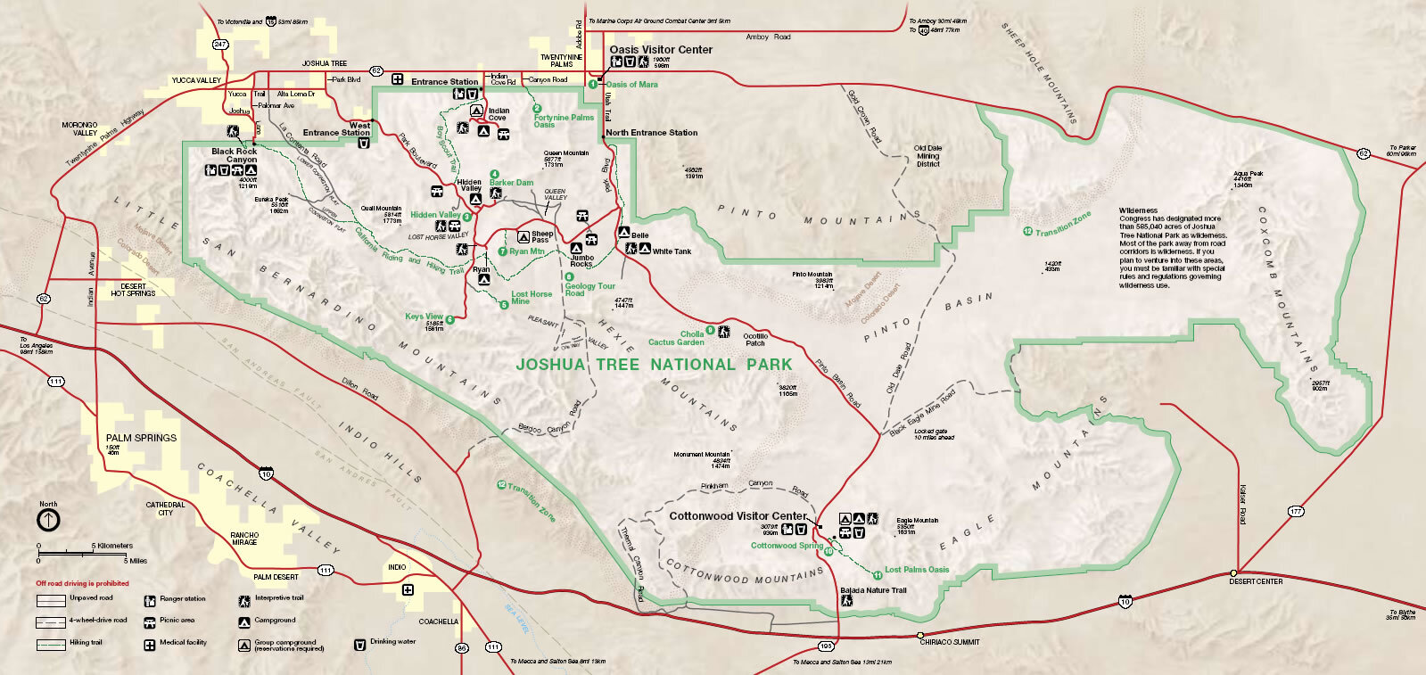
Here's a link to more
Joshua Tree National Park Maps

Recommended Rading
Joshua Tree National Park: The Complete Guide (Color Travel Guide)
Joshua Tree National Park boasts some of California's most dramatic desert scenery. From the weird and wonderful Mojave Desert to the vast and stark Sonoran Desert, Joshua Tree: The Complete Guide reveals the park’s highlights and hidden gems.